Practice
Land Suitability and Participatory Mapping: Negotiating Territorial Knowledge
2025–2026
General Coordinator:
Ignacio Cardona
Cartographer:
Ricardo Avella
Institutions:
Intendencia de Maldonado, Dirección General de Gestión Territorial; Ambá; Spatial Opportunity Lab (SOLAB).
Location:
Maldonado, Uruguay
*
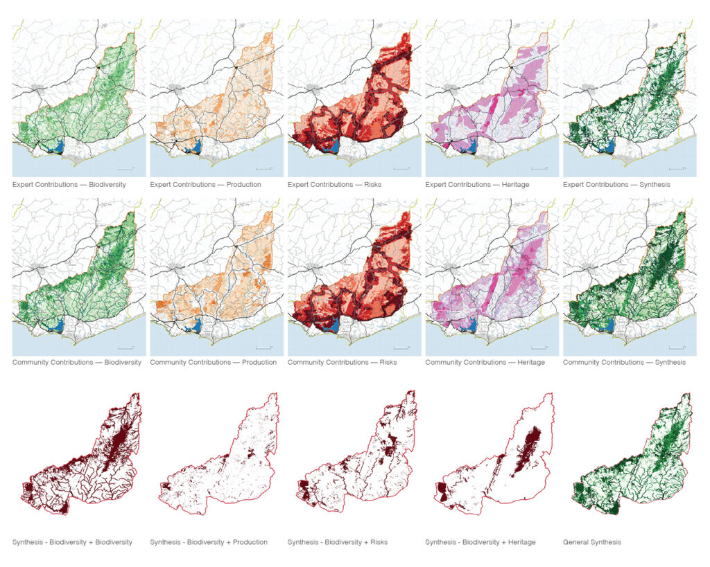
Developed as part of the Territorial Planning Framework for Proyecto Carapé, this methodology combines land suitability analysis with participatory mapping to integrate technical expertise and situated territorial knowledge. Expert and community contributions were independently mapped and compared through GIS-based multicriteria analysis across biodiversity, production, heritage, and territorial risks.
The comparison revealed distinct forms of knowledge: communities expanded the geography of biodiversity and heritage beyond official maps and identified nature-based productive landscapes beyond the road-centered patterns emphasized by experts, while risk perceptions converged around real-estate development associated with new rurality. By overlapping these contributions, the method establishes a dialogical balance between conservation and development, making different forms of territorial knowledge visible, comparable, and negotiable.